 DC024106
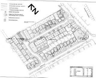
Erection of fifty nine 3-bedroom houses
Edgeley Centre, Avondale Road/St Lesmo Road, Edgeley.
Case Officer / Telephone: Miss KL Clarke 0161 474 3557
Consultation Expiry: 29-09-2006
Documents: click here or see Hygarth House, 103 Wellington Rd Sth.
The Report on the Ground Investigation has an interesting review of historic maps. The earliest maps (1874 & 1882) show the site as two fields with partially tree-lined boundaries. The surroundings are open fields as well.
By 1898/9 St Lesmo Road has been built, but the site remains a field though trees are no longer shown. To the North East, St Augustine's Church and vicarage have been built.
By 1910/1 one of the boundary fields has disappeared, while another has been extended. A Sunday school has been added to St Augustine's church. A small bounded area, perhaps an allotment, intrudes into the site. An unnamed road now forms the Southeast border of the site.
1922/3: the site is unchanged except for the widening of St Lesmo Road and an embankment alongside the road.
By 1934 the field boundaries have been removed and the site is shown as a playing field. It is mostly surrounded by housing. To the south west, the Avondale Works has appeared, described as a ribbon weaving factory. There is no longer an embankment shown along St Lesmo Road, instead there is a row of trees.
The only difference on the 1938 map is that the previously unnamed road to the South East is now shown as Avondale Road.
The site has become the Avondale Secondary Modern School on the 1959 map.
The 1960 map is similar except for an unidentified circular feature on the site, which does not appear on any other map.
The 1965 and the partial 1971 maps are consistent with the 1959 map.
While the 1978 to present, show the removal of three of the school buildings have been removed from the yard area.
The soil is a mixture of glacial clays and glacial sand. Though the boreholes went down as far as 6 metres, they didn't reach the sandstone, which outcrops north of the site.